|
|
|
1749:
Lewis Evan's "Map of
Pensilvania" locates the Bushkill River, Broadhead's
Plantation, and Dupui's trading post; the Walpack Bend
in the Delaware River is visibly noted on maps for the
first time.
|
|
| |
|
 |
|
|
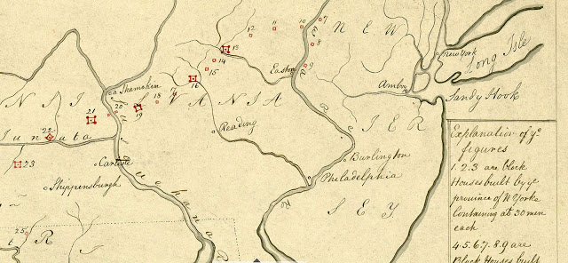
1756:
Map
commissioned by General Shirley during the the French &
Indian War depicts the location of area fortifications;
the Dupui trading post (designated as a blockhouse
capable of housing up to thirty men), appears as #10 on
the map.
|
|
| |
|
 |
|
|
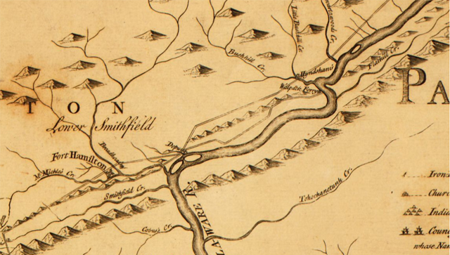
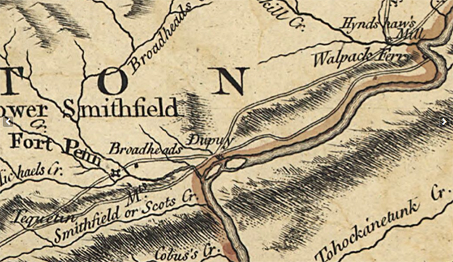
1759:
Map
by Nicholas Scull depicts Upper & Lower Smithfield,
local Fort Hamilton, area roads, the Walpack Ferry
Crossing, Brodhead's plantation. the site of Hyndshaw's
Mill and the location of Dupui's trading post.
|
|
| |
|
 |
|
|
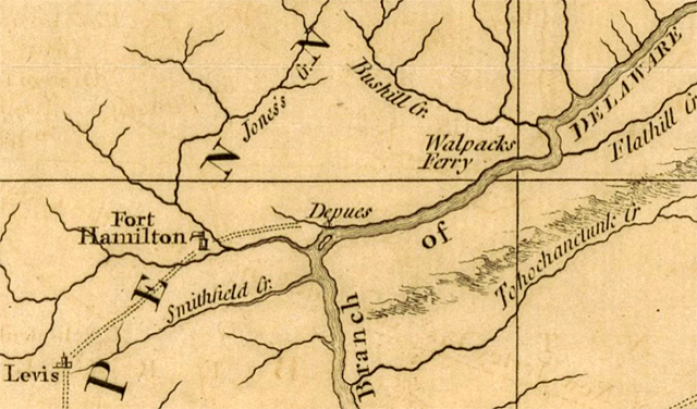
1768:
Map
by Samuel Holland depicts Depues, Fort Hamilton and the
Walpack Ferry crossing.
|
|
| |
|
 |
|
|
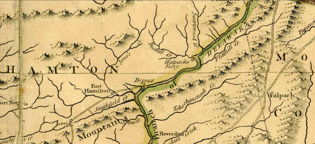
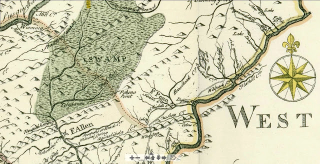
1770:
Map
by Nicholas Scull shows the area's Great Swamp and
Shades of Death, Dupui's trading post, the Walpack Ferry
crossing, Fort Penn and Fort Allen.
|
|
| |
|
 |
|
|
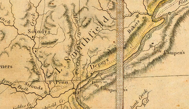
1777:
Map
by William Fadden depicts Dupui's trading post (now
spelled as Dupuy), Broadhead's plantation, Fort Penn,
the Walpack Ferry and Hyndshaw's mill.
|
|
| |
|
 |
|
|
1777:
From
"A NEW AND ACCURATE MAP OF THE PRESENT SEAT OF WAR IN
NORTH AMERICA" shown in The Universal Magazine of June
1777, Dupui's trading post is depicted along with Fort
Hamilton and the Walpack Ferry site
|
|
| |
|
 |
|
|
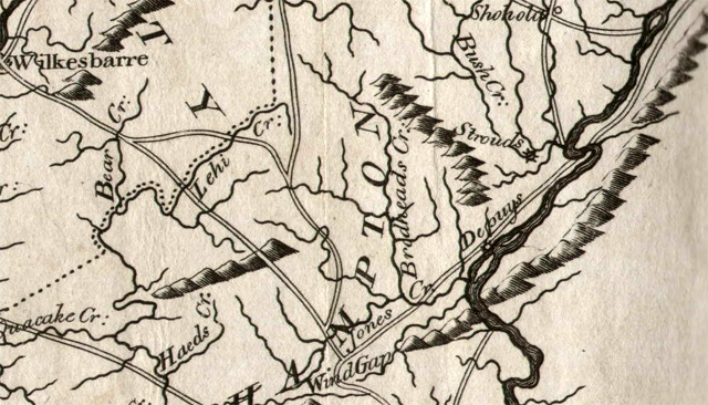
1792:
From
Howell's "Map of the State of Pennsylvania", Dupui's
trading post is shown (now spelled as Depuys)
along with the location of Fort Penn.
|
|
| |
|
 |
|
|
1795:
Map
by Samuel Lewis showing the location of Depuys.
|
|
| |
|